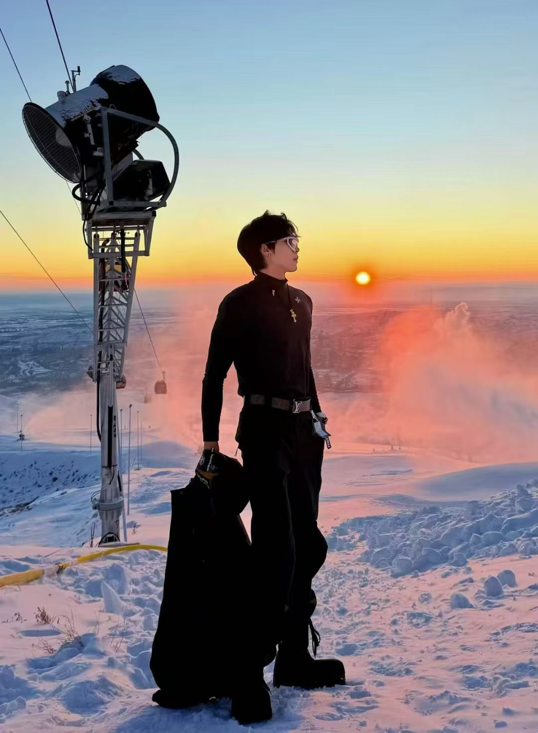


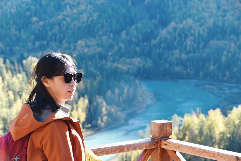
The most beautiful place to see autumn scenery in September is definitely Northern Xinjiang
Where is Northern Xinjiang? Narrowly speaking, Northern Xinjiang is "my Altay". With Tianshan as the dividing line, to the north, until the border, it is called Northern Xinjiang. Most of this is also the Junggar Basin. To the south, until the Kunlun Mountains, it is called Southern Xinjiang. Most of this is also the Tarim Basin. Fly to Urumqi from any city in the country, and you can see the Tianshan Mountains and the highest peak in the east - Bogda Peak (yes, the highest peak is actually on the western border) on the left. Then it means that you have landed in Urumqi and reached the Junggar Basin. Urumqi, Hami, and the part adjacent to Gansu are also called Dongjiang. This is the composition of the entire Xinjiang. "Great beauty Xinjiang", "I don't know the size of the motherland until Xinjiang"... Xinjiang is really big, and other cities are really far away to Xinjiang. But what still drives us to visit Xinjiang several times "not far and thousands of miles"?

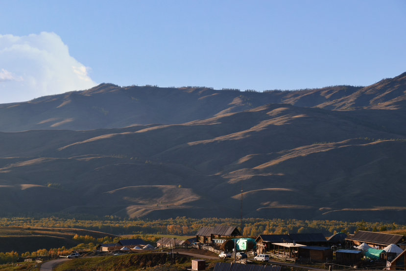
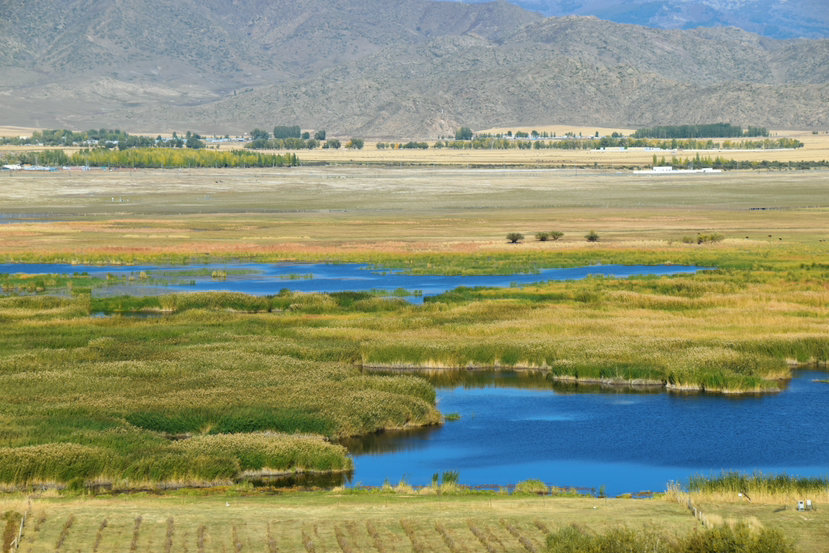
Keketuohai does not have a sea. It is more of a border town, but it is widely known to the world. On the one hand, it is because of the song "Shepherd of the Kokutuo Sea", on the other hand, it is the birthplace of the Irtysh River, the only international river that flows into the Arctic Ocean in China, and on the other hand, it is also because it is rich in minerals used in nuclear weapons. In the early days of liberation, Kokutuo Sea paid off 60% of the Soviet debt of the motherland in a single mine. Therefore, it made a significant contribution to the prosperity of the motherland.

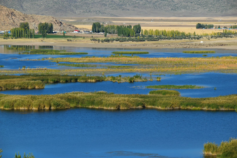
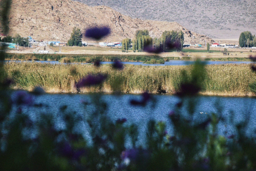
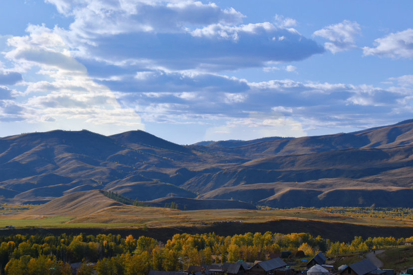
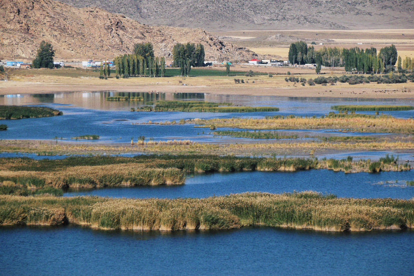
Keketuohai is a small town located in the border area, over the canyon is Outer Mongolia. Not far from the town is a small lake called Coco Tosu. In autumn, the reeds float, and they climb the mountains to shoot the reed scenery of the entire lake area. The scenery is very beautiful. The altitude in northern Xinjiang is not high, but the climate is cold. The Gesang flowers grown here 🌸 much taller than those in Tibetan areas.
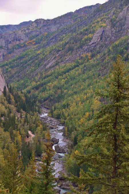
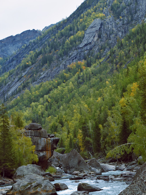
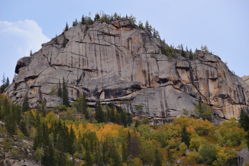
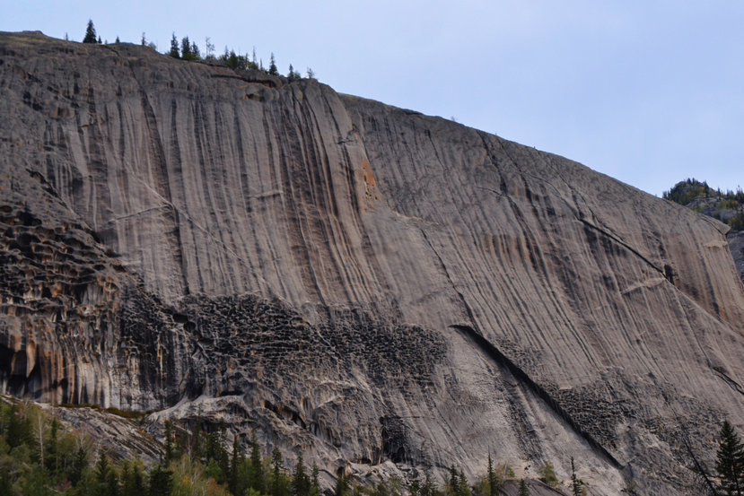
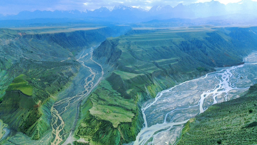
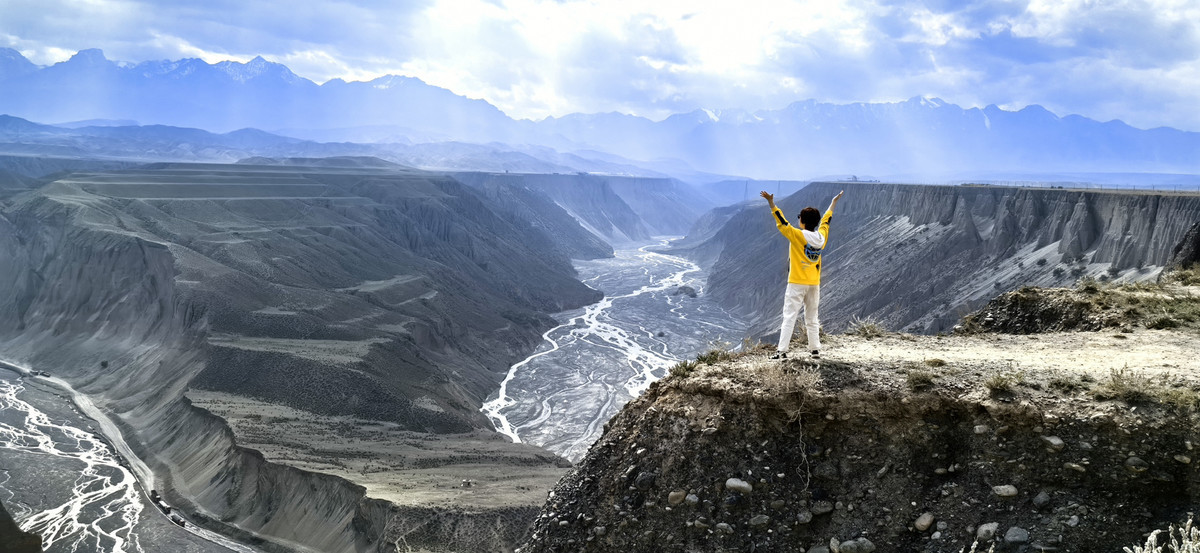
Keketuohai is better known as the Grand Canyon of the Irtysh River. As a geological park, this is also the birthplace of the Irtysh River. The stunning scenery of the canyon can only be seen when climbing the peak (it takes some foot work and takes a non-scenic road), but the beautiful scenery that comes into view is absolutely breathtaking. Compared with small scenes like Zhongshen Mountain, the vast canyons and forests of nature are more breathtaking!
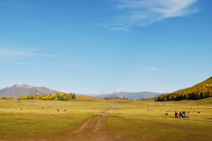
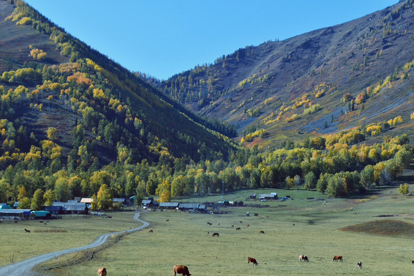
The journey from Urumqi to Keketuohai is exactly the journey taken by the heroine in "My Altay". Through the desert 🏜️, across the protected animal living area, all the way along the rich beacon! It is not difficult to imagine "the dry heat of summer, the boredom of squeezing in the bus", and you can also experience the coolness of being swept away by all the dry heat when you arrive at Keketuohai. Of course, now our travel conditions are good, and the air conditioning allows everyone to stay comfortable when passing through the desert area. When you step out of the desert, you can see the unique transition of Kazakhstani herders.
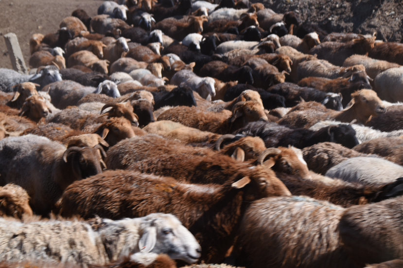
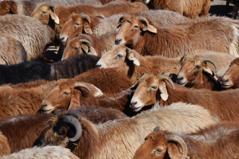
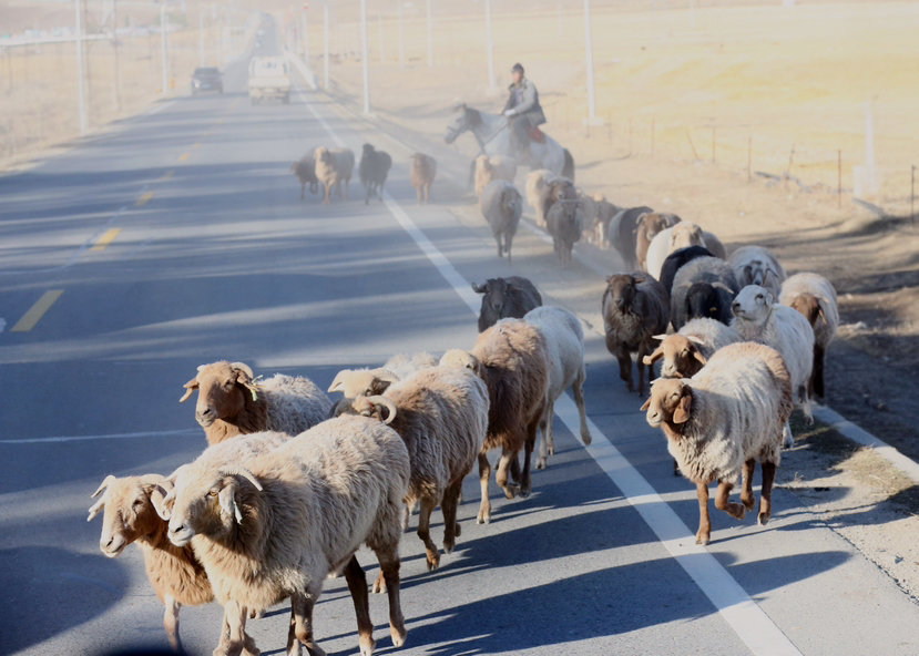
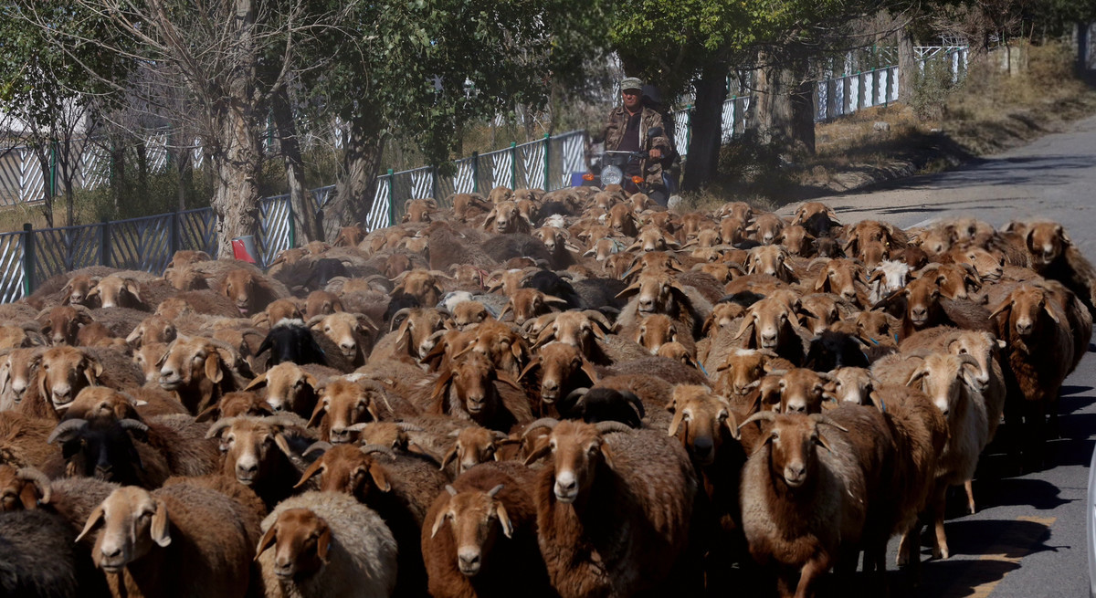
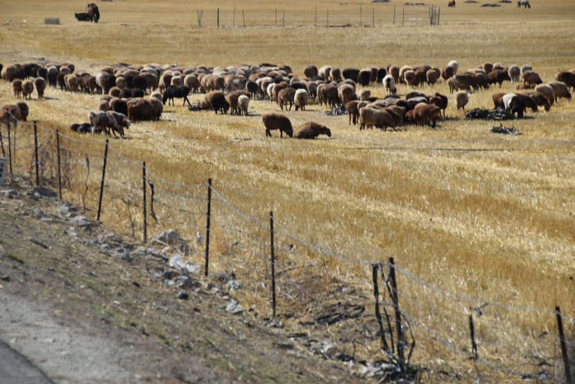
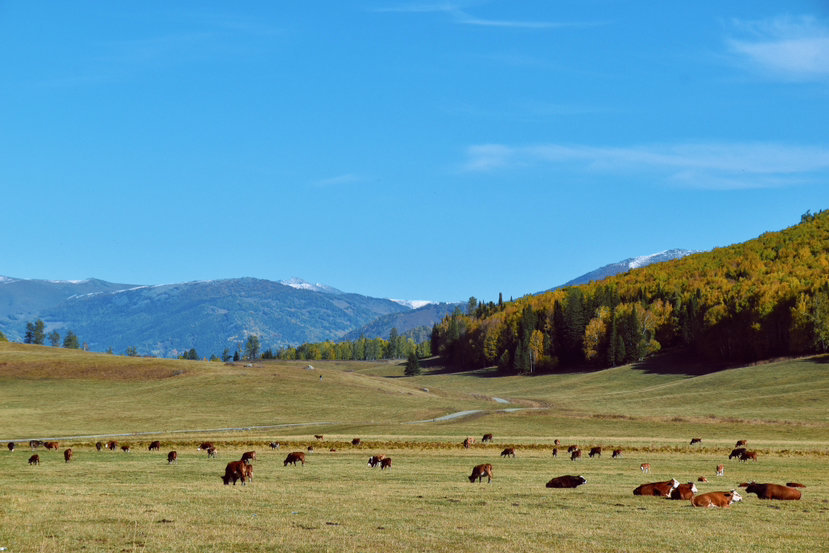
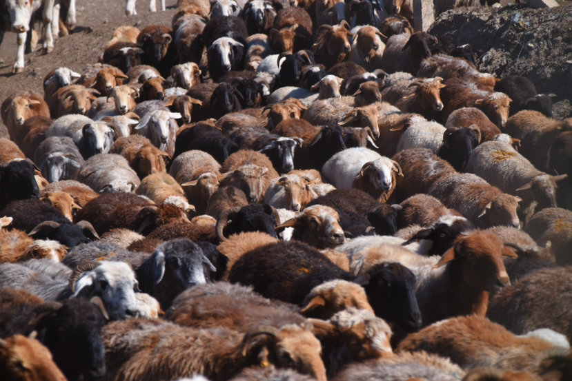
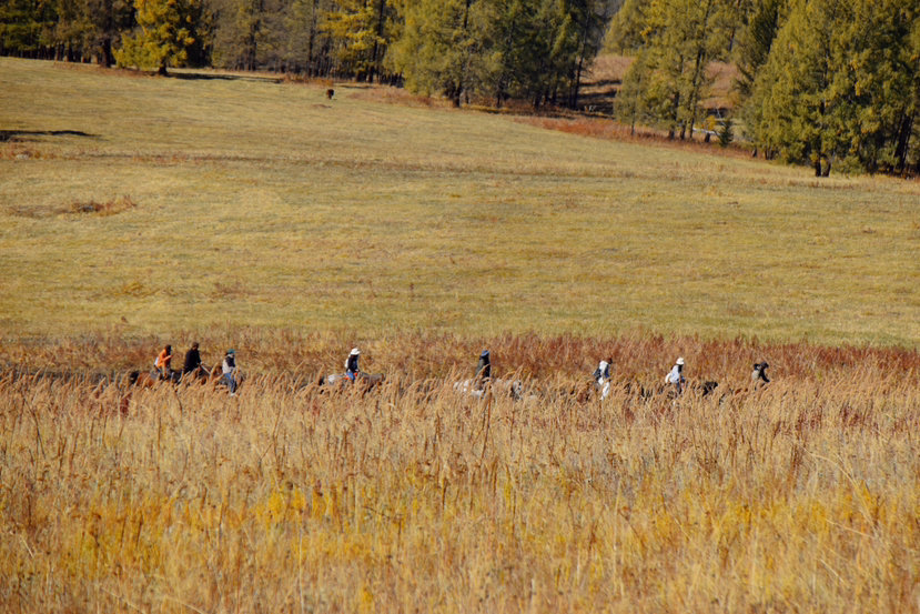
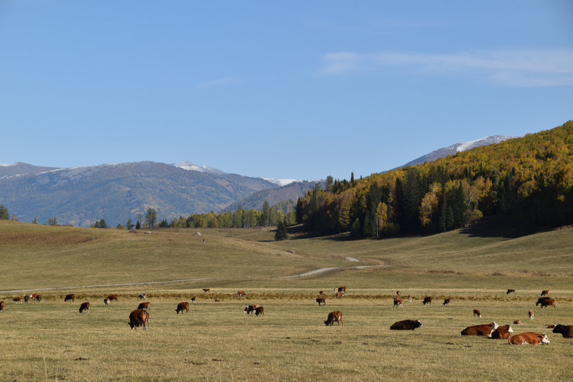
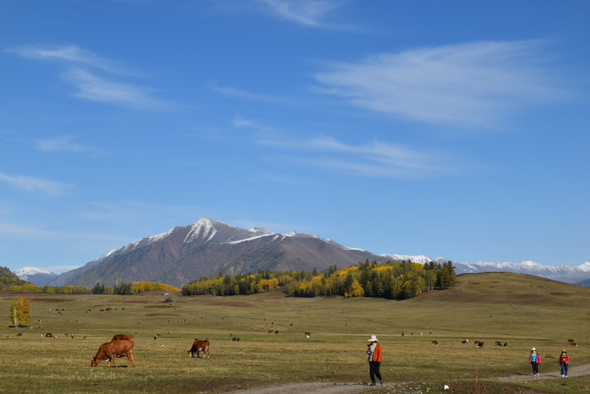
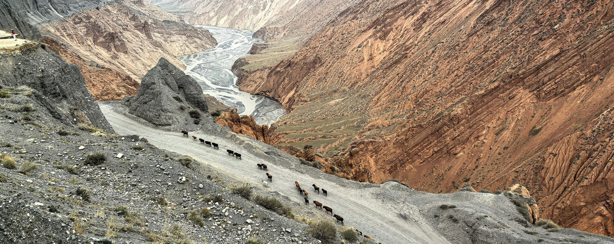
Kazakhstanis are more nomadic; especially in the northern region of Xinjiang. From spring to winter, three pastures are transferred a year. This time we happened to be transitioning from summer pastures to autumn pastures. On the way to Keketuohai, you can see herds of cattle and sheep. The rules are perfect, crossing the road, walking through the wilderness, and walking into the distance! At this time, "The Shepherd of Keketuohai" rang in my ears, thinking of the youthful throbbing of Ba Tai and Wenxiu, and thinking more about the love and marriage of nomads.

Baihaba is actually the least congested road into Kanas, especially during the peak tourist season in autumn, but few people know this road.
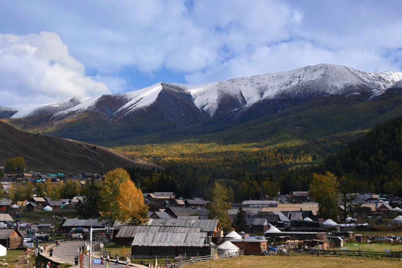
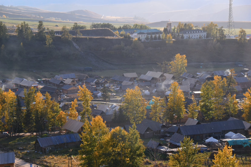
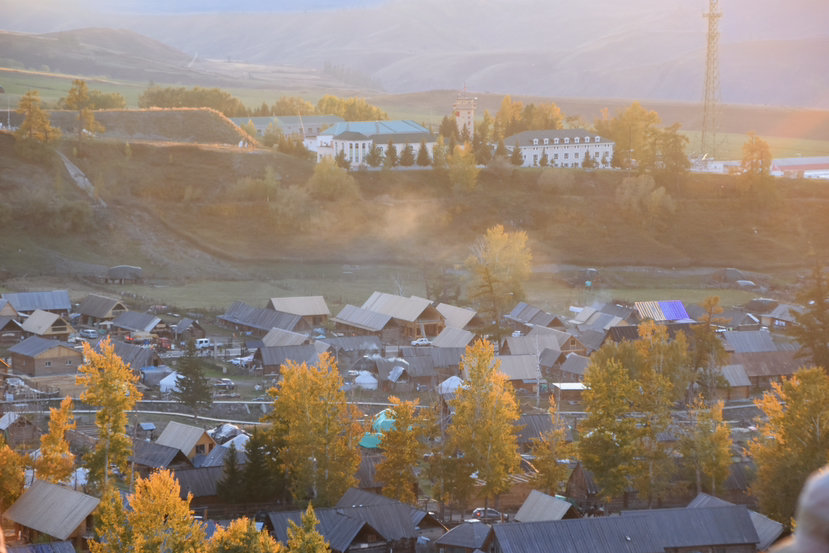
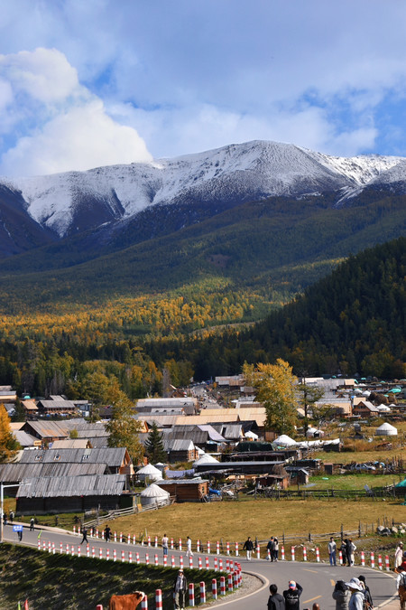
Located in a small town next to the Grand Canyon on the Sino-Kazakh border, there were originally only Tuva people with less than 100 households, but as the "first village in the northwest", this border feeling automatically attracts many tourists. The People's Liberation Army at the border guard station in the village is guarding the border, and it can also see the border line in its entirety (with barbed wire).
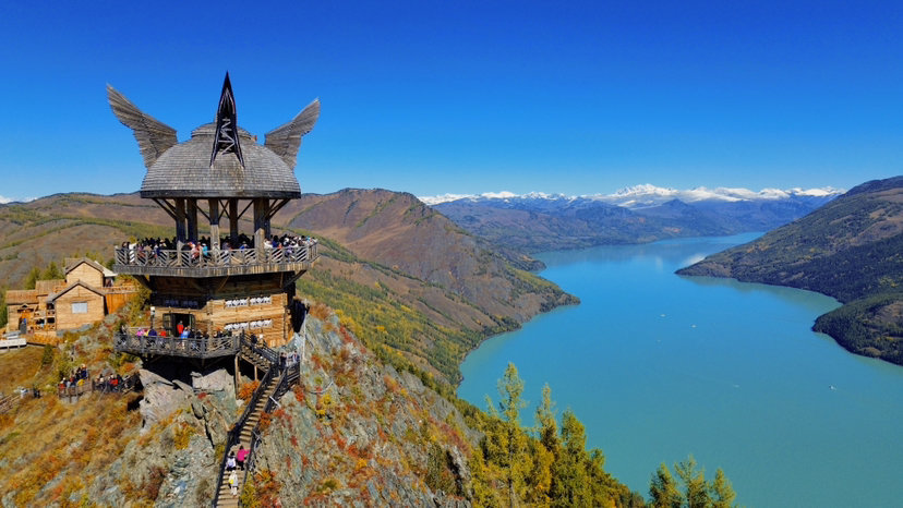
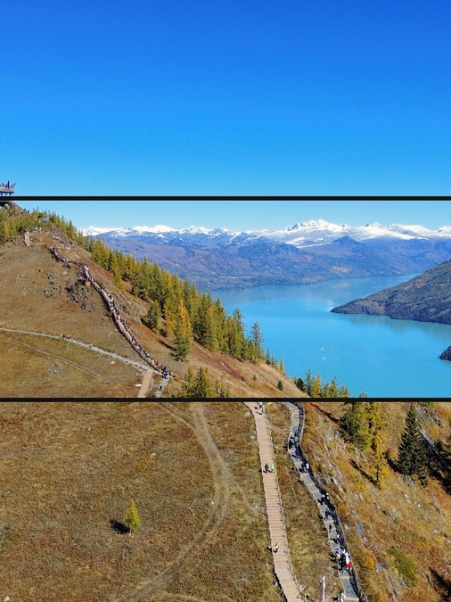
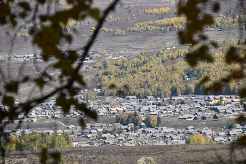
Tuva people, as a branch of the Mongolian people, now mainly live in the Kanas area, with a population of less than 2,000 people. Yes, Baihaba also belongs to the Kanas area. Transfer from the gate of Baihaba Scenic Area to the transit bus in the scenic area, arrive at the parking point of Baihaba Jing, and then transfer to the village bus to go to the small wooden house. Although many places in the village are being newly built, the whole old village is still very artistic. You can walk through the village, then take the bus to the terminal (there are birch forests), then go to the sky grassland, and then climb up the sunset observation deck from the post office. The location of the first observation deck is the best, you can see the smoke and sunset of the whole village, and the location from the snow-capped mountains is also very good 👍
If you still have energy at night, you can get up and look at the stars. But to see the stars, you need to go near the terminal, and the light pollution will be relatively small. There are buses to arrive before 22:00. After reading it, you can walk back to the wooden house. We cancelled the idea of the starry sky because it was the Mid-Autumn Festival and the moon was full.

You can get up in the morning to see the morning fog, but it takes time. Bai Haba is in the mountain, so you have to wait until the sun shines on the wooden house, about 9:00-9:30, if you stay for 2 days, it will be fine.
The village is well-equipped to eat and drink, of course, petty bourgeoisie supplies should not be enough, but slow down and walk around, sit down and drink a cup of yogurt, it's completely fine.
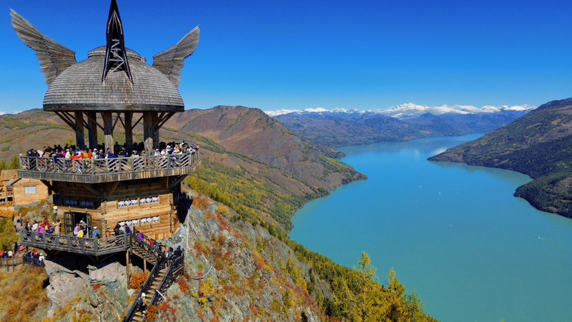
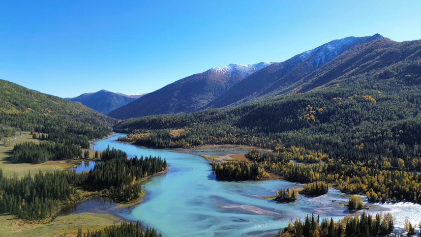
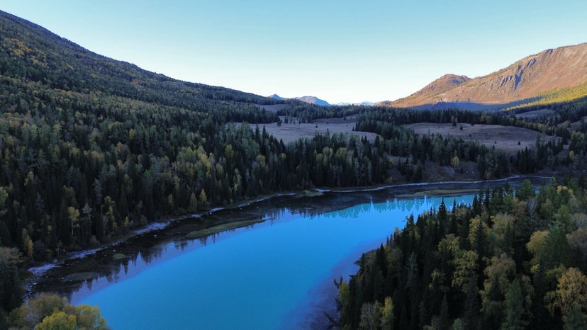
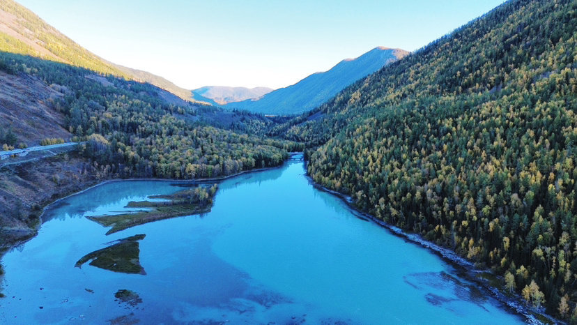
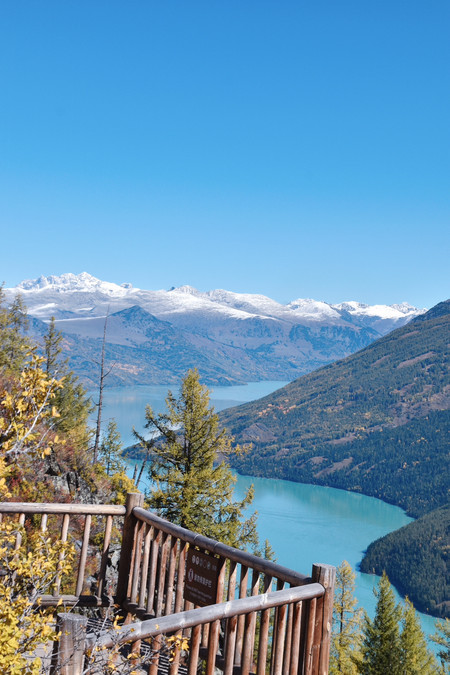
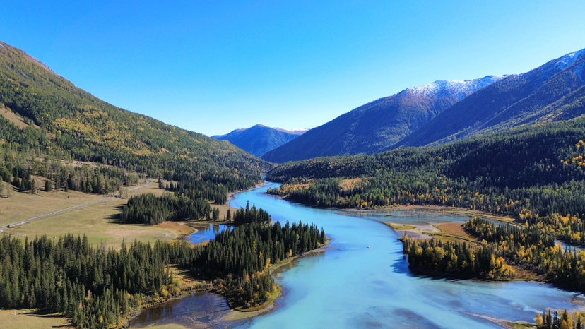
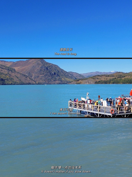
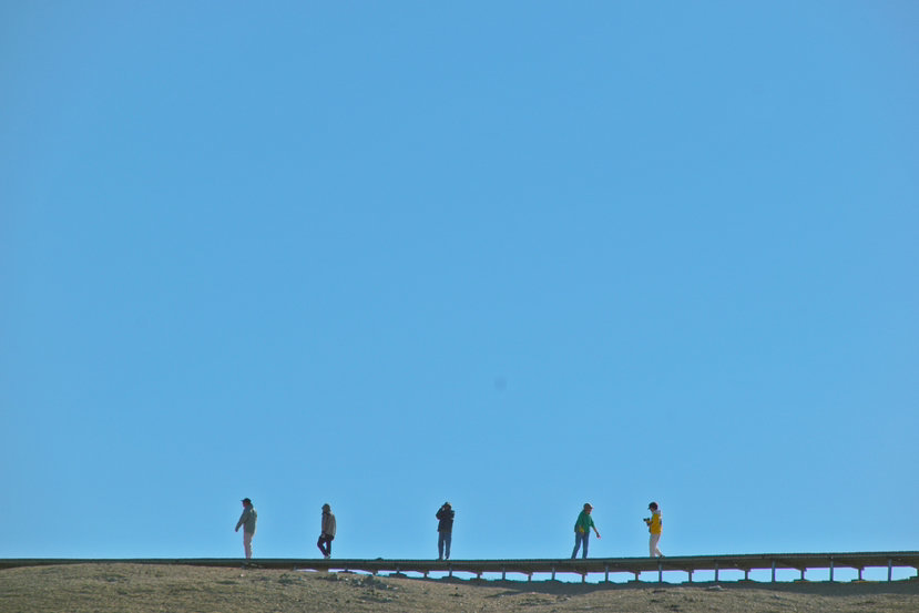
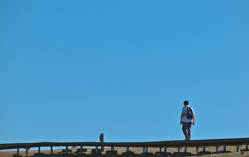
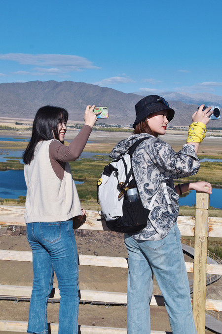
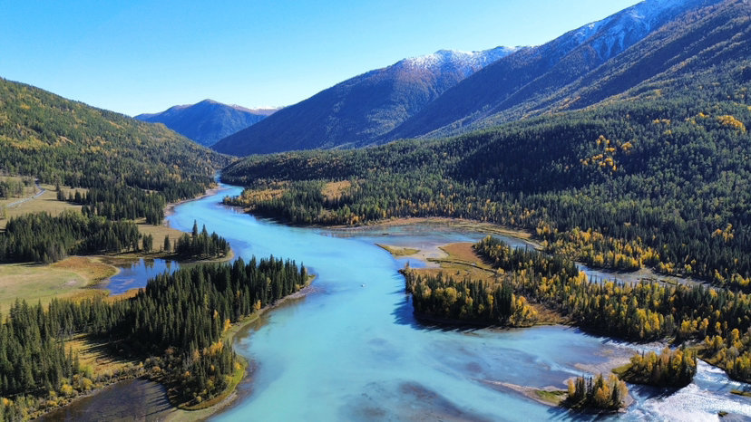
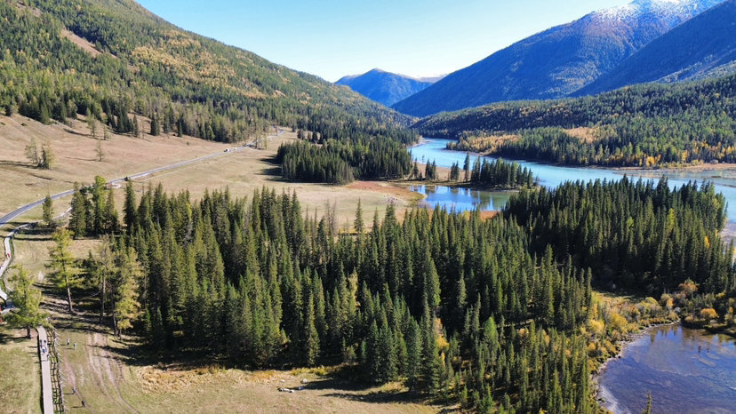
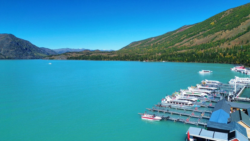
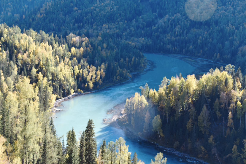
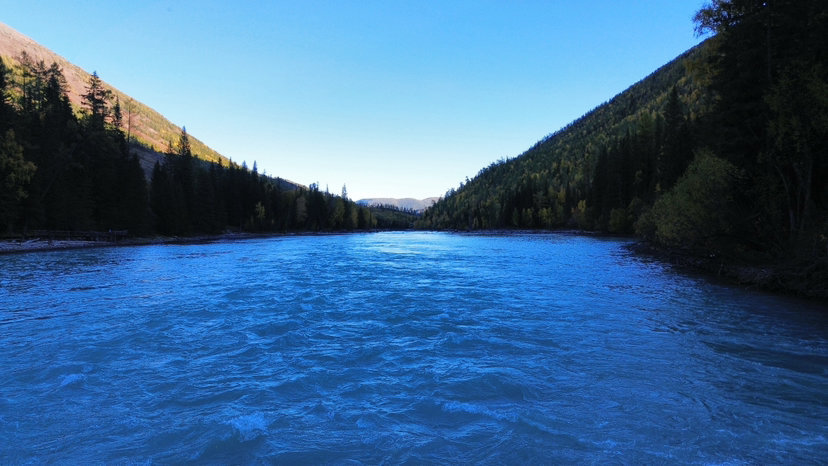
If the viewing platform is to watch the fish monsters in the past, until you see the entire panorama of Kanas, you can actually feel the charm of blue paint on the trail by the lake there; and the immersive Sanwan is like a fairy dream. The viewing platform needs to grab tickets on the same day, and it is often closed in the morning due to weather reasons, such as ice on the road. So keep an eye on the small progress of grabbing tickets in the morning to ensure that you can grab tickets. The lake in Kanas is a very beautiful and beautiful place. The lake is running out like blue paint. As long as you see the lake, you can see the "paint" and feel that the water is blue. The birch forest and Siberian larch on both sides form a very beautiful picture. With the snow-capped mountains in the distance and the sunshine shining, it is really the scene of the hostess doing laundry in "My Altay". Sanwan is the abbreviation of Shenxianwan, Moon Bay and Wolong Bay. If you visit Shenxianwan, you will feel bored, but the morning fog and the blue river water in the morning are really a wonderland. You can harvest a large area with drones and cameras. This is the most beautiful place in my opinion. From Moon Bay to Wolong Bay, you can hike, and you can walk for about 5 kilometers, including the way down the mountain. The plank road by the lake is very comfortable to walk, and it is also very beautiful.
Hemu - Independence Altay

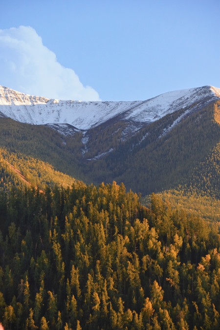
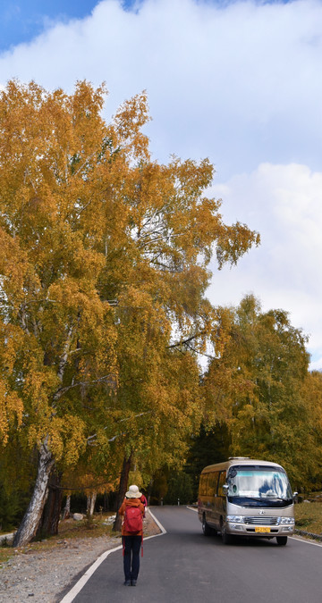
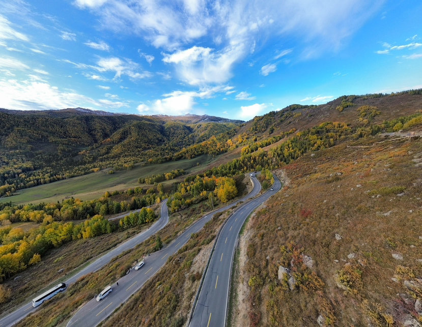
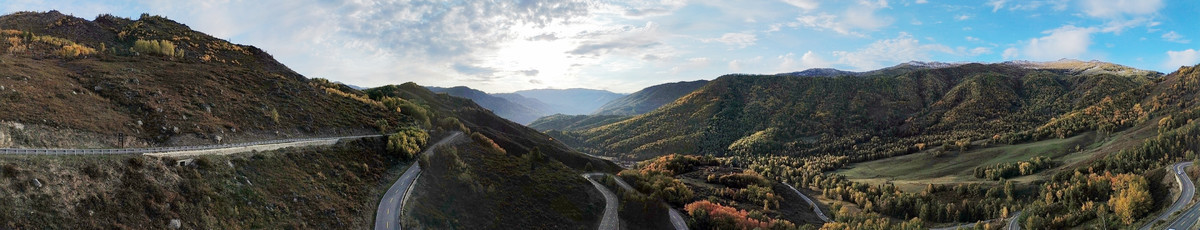
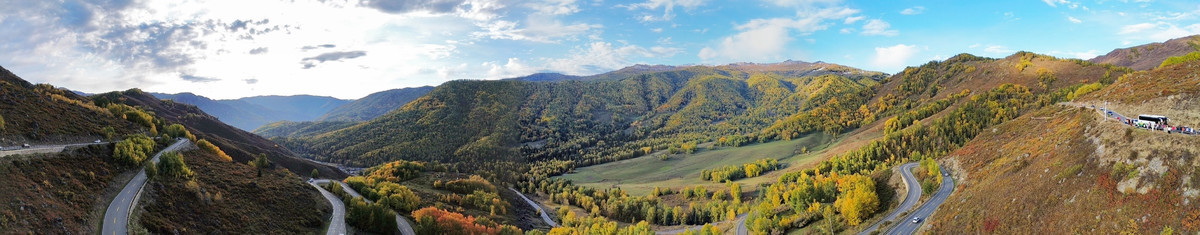
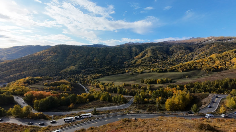
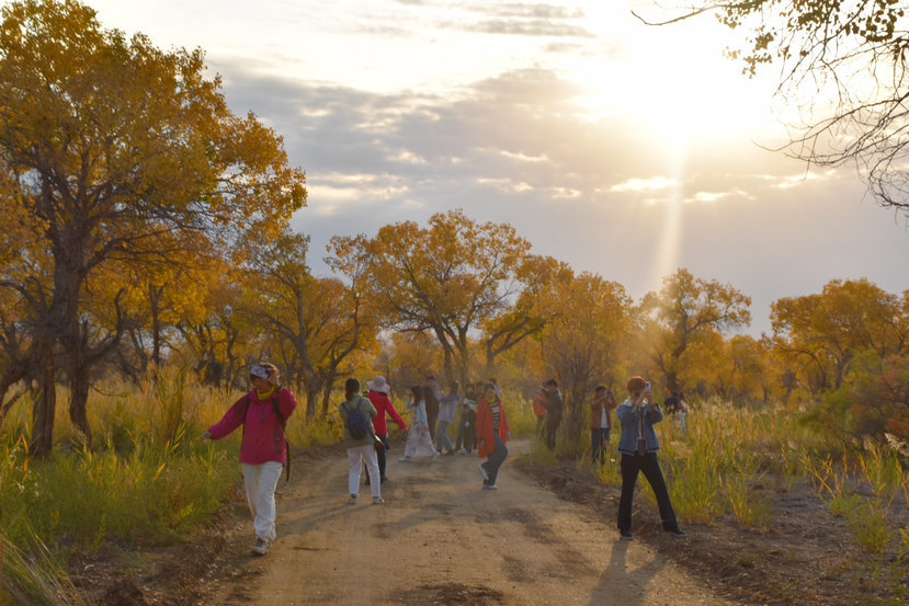
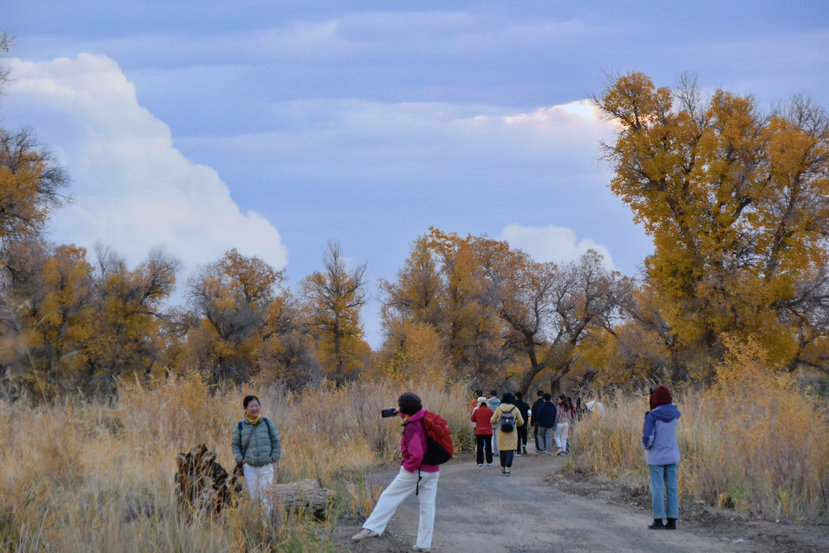
This trip really feels like Xinjiang, and the place like Altay is in Hemu, to be exact, in the beautiful peak village of Hemu. The road from Kanas to Hemu is the most prosperous place for autumn scenery on this trip! Looking down from the top of the Panshan Highway, the winding mountain road and the deep and shallow yellow in the distance merge into a colorful forest feast. Where you enter the eye, it is a grand and majestic collection of various yellows and reds.
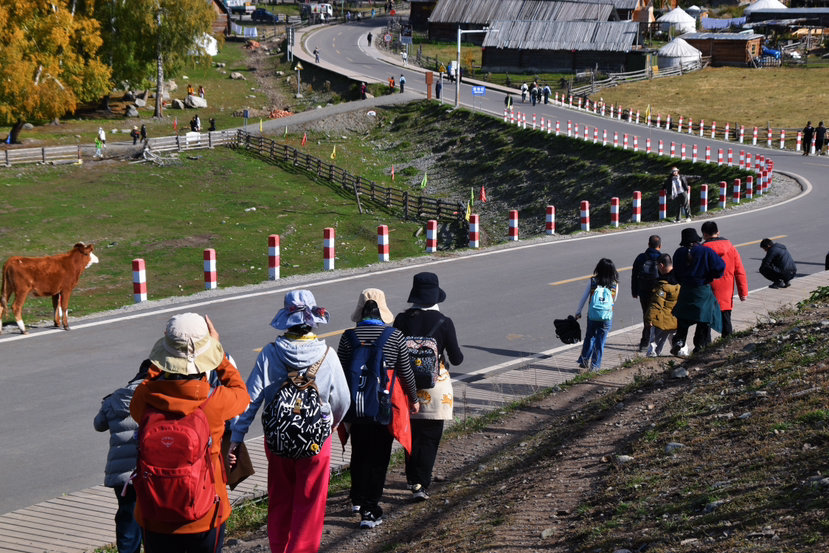
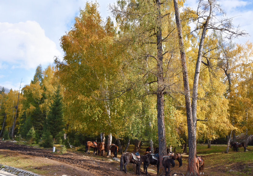
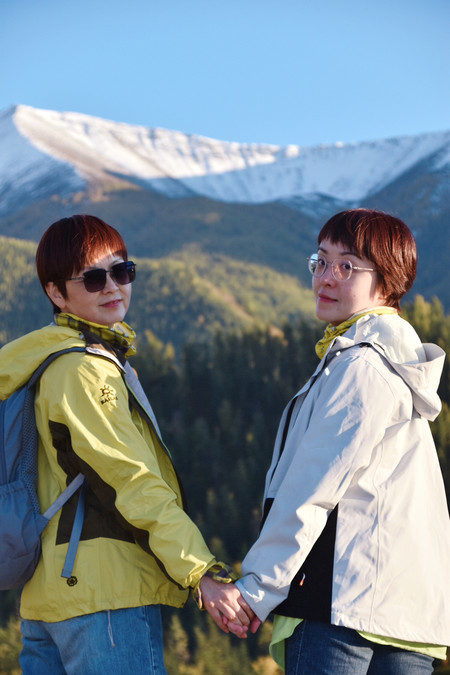
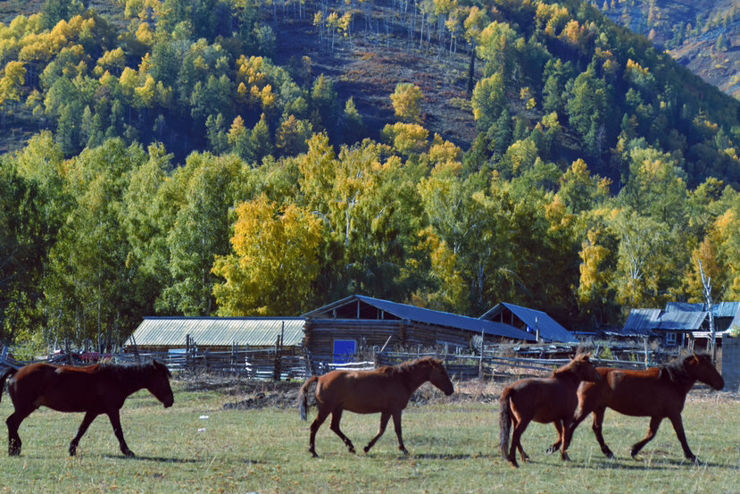
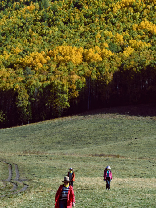
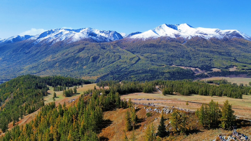
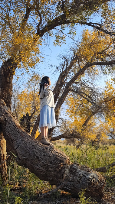
From Hemu Village to the observation platform, you can hike to the beautiful peaks, and you can also ride horses. Hiking can be played while walking. We are like Wenxiu, walking all the way to see and explore one or two. It took almost 4 hours to reach Beautiful Peak, but we have had enough fun and crazy enough all the way. Beautiful Peak is well worth visiting! Originally a small village where only one family lived, now there are only about 12 households. In the mountain valley under the snow-capped mountains, there are mountains on all sides, and in the place where the houses are connected to the mountains are large grasslands and birch forests. Cows and sheep are very comfortable lying down and eating grass, feeling at ease. Here you can really appreciate the feeling of snow-capped mountains, grasslands, birch forests, cattle and sheep, and wooden houses blending into one picture; here you can really appreciate the feeling of Xinjiang being so big, with so much land and so few people (there are really few people going); here you can really appreciate the feeling of Ba Tai riding a horse. Therefore, I say that this is the real Xinjiang, the real Altay!
DAY1: Urumqi collection
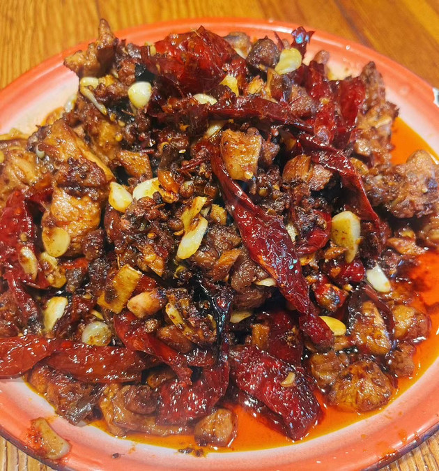
The first thing I did when I went to Xinjiang was jet lag. At 12 noon, I was so hungry that I found that the spicy chicken shop that I wanted to eat had not opened yet. I went to wash my hair and cut my hair. I dawdled until 1:30. I was almost hungry and exhausted, and the shop finally opened. I ate a large plate of spicy chicken in one go, which is much more authentic than Chengdu's! Huge delicious, recommended! I went to buy a new hat in the afternoon, and I also saw how expensive Xinjiang is. It is said that all walks of life in Xinjiang belong to monopoly industries, and everyone catches up with Beijing, Shanghai and Guangzhou in eating and wearing these two things. Indeed, I bought a hat, 180, and the meat hurts.
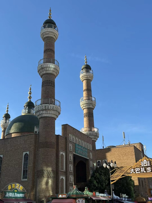
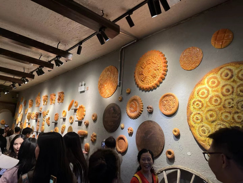
After buying a hat, go to the Grand Bazaar to meet with friends. If you go to Xinjiang for the first time, the Grand Bazaar is a good place to feel the ethnic customs. Recommended. Uyghur-style houses, small objects with the characteristics of Maimaiti and song and dance performances make you feel like you are in a foreign country. By 8:30 pm, the sky is getting dark one after another, but the night in Xinjiang has just begun, and it is still lively at 1-2 am.
DAY2: Urumqi-Kokotosu Lake-Kokotohai
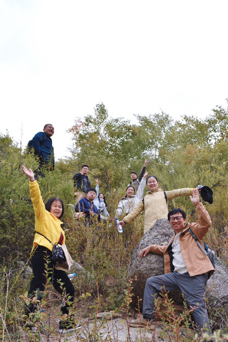
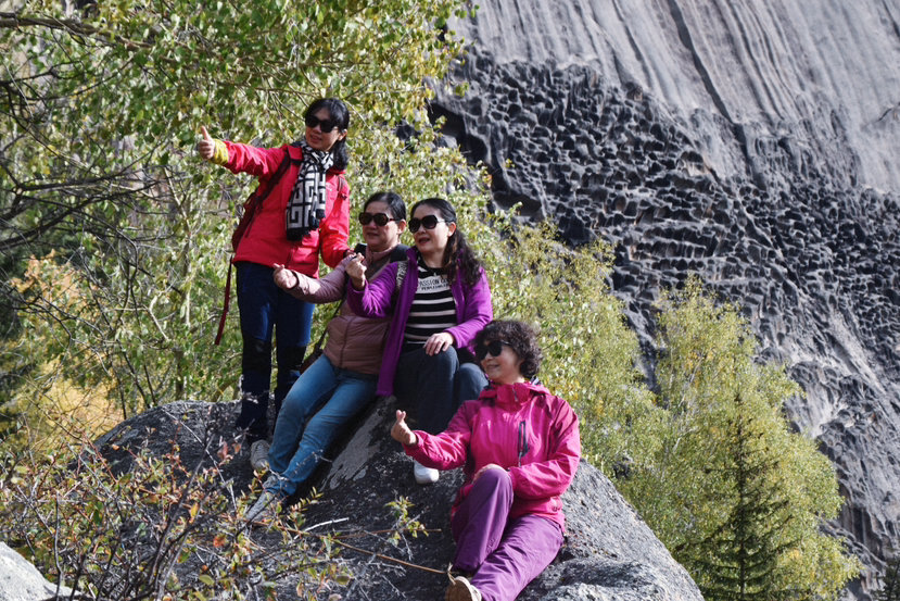
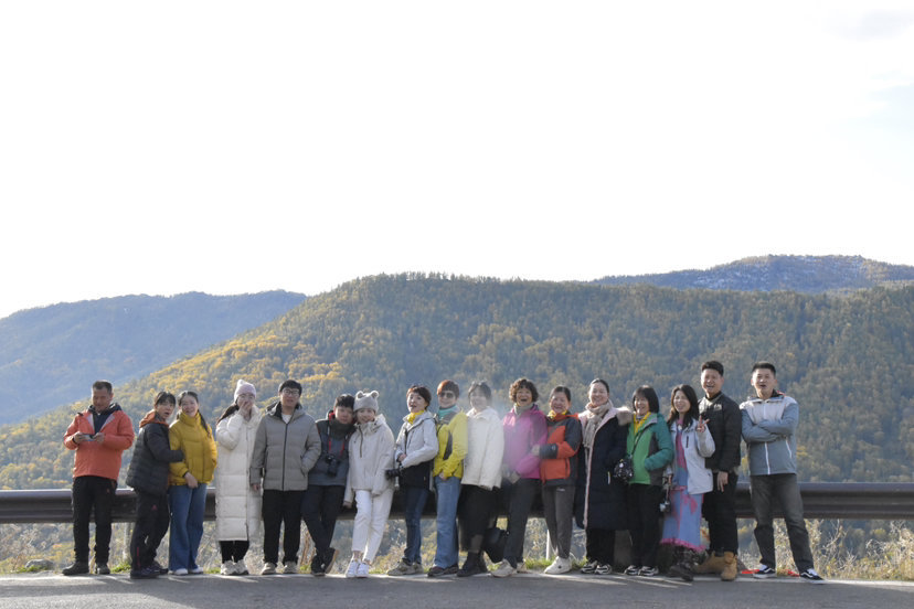
Today is basically on the way, from Urumqi through the desert, through the Junggar Basin, through the wildlife reserve, all the way to Fuyun County, to the town of Kokotosu. Kokotosu Lake used to be a place that did not charge tickets, but it is said that there are too many tourists, and it was developed into a scenic spot to collect tickets. Haha~ I took the first group photo of this trip on the mountain. Everyone was in good condition while climbing the mountain. The other group friends we were traveling with have all scattered away, and the 20 of us are still walking together, and the team spirit is strong!
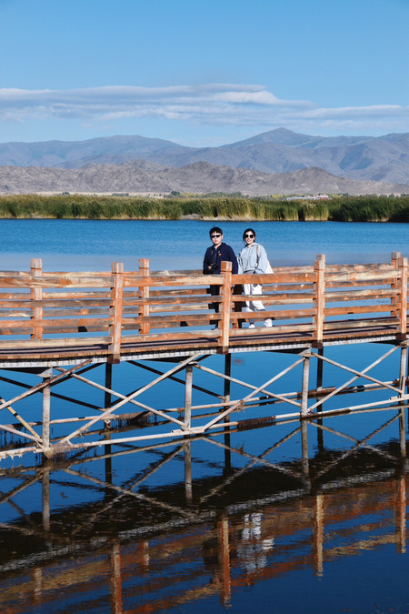
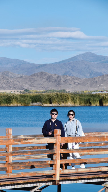
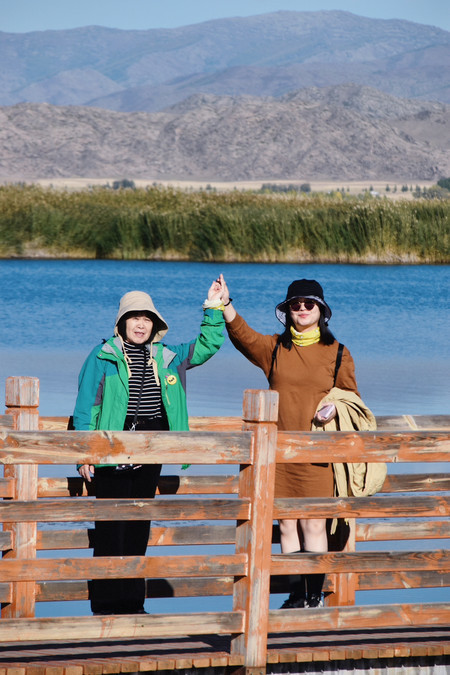
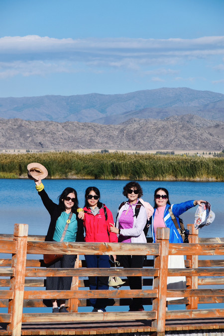
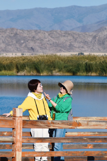
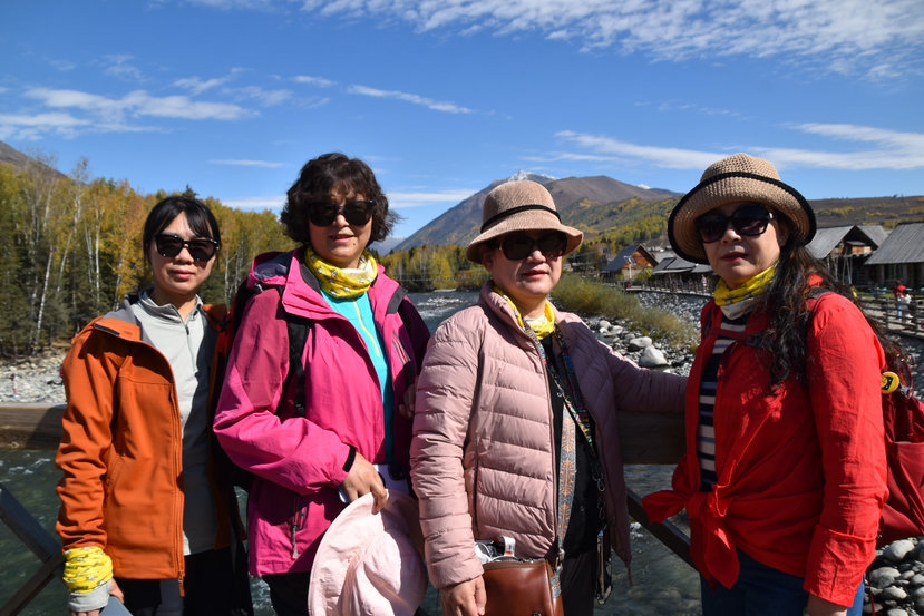
Going to the lake is very suitable for taking pictures of the "Covered Bridge Dream" feeling. Maybe it is close to the sunset, which is somewhat close to the Lover Bridge in Mandalay, Myanmar. Everyone, whether they are couples or sisters, takes "lover photos" on the bridge, which is very romantic. We stayed in Cocoa Tuohai Town at night, and those who had the energy immediately ran to "Mine No. 3". Before we could go, we said that it closed at 8 o'clock, so we walked along the river to find something to eat. Because Cocoa Tuohai Town is a border, the price is relatively high, and the food is more expensive.
DAY3: Keketuohai Geopark-Burqin
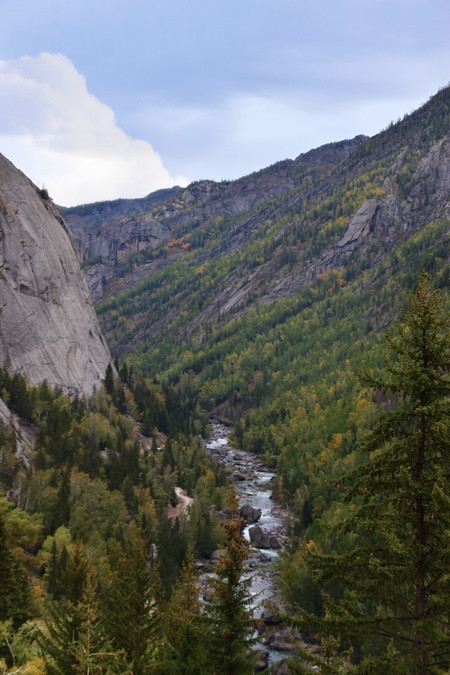
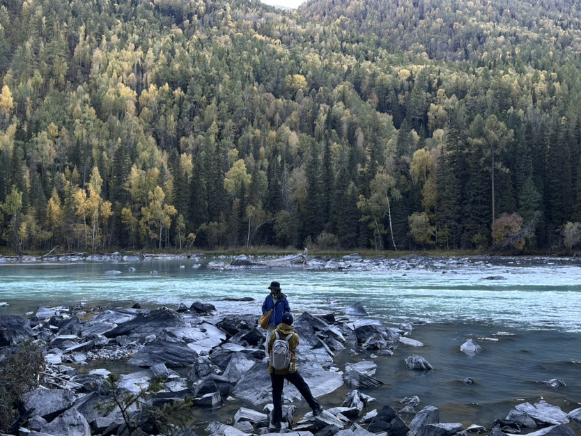
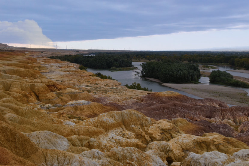
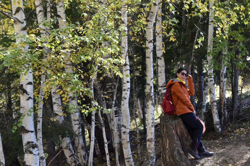
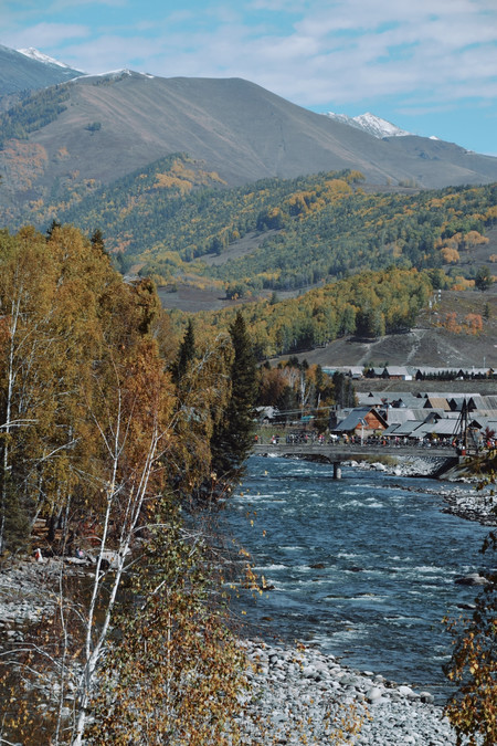
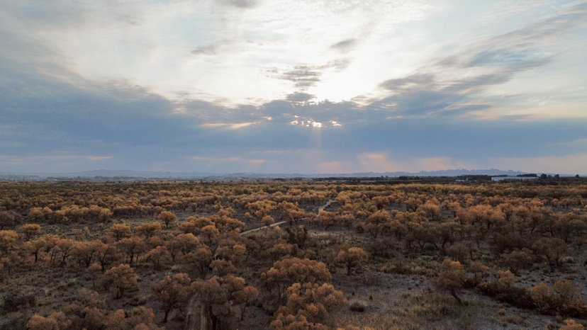
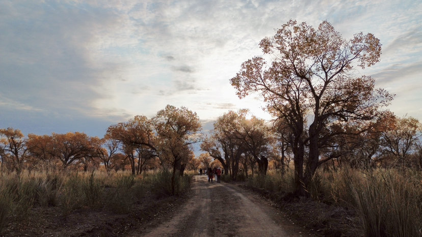
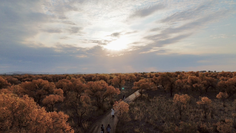
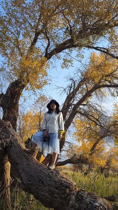
Keketuohai Geopark is the Ergis River Grand Canyon. The canyon is very deep and long, and we mainly took the route in the scenic area. We took a little detour and climbed a little mountain to see the panorama of the canyon, which was worth the trip. The canyon is deeper and more magical from above, and may be more beautiful than the Mountain of Gods and various Buddhist niches. Along the way, the birches on the banks of the Ergis River are more comfortable with the water.
Go to the Grand Canyon at 9 in the morning, climb up the mountain and slowly get too much sunlight to shine on the canyon, and the scenery is more obvious. Come out to town for dinner at noon, and continue to rush to Burqin after eating. I originally wanted to rush to the multicolored beach and see the sunset, but the sun was about to set before I reached Burqin, so I had to give up until the next day. This day is the Mid-Autumn Festival, there are 2 friends in the group who are about to celebrate their birthdays, because everyone has gone to the mountains in the following itinerary, and if they can't buy cakes, they will focus on the Mid-Autumn Festival together! You are very caring, preparing moon cakes and big cakes for everyone. After dinner, you can go to the Internet celebrity bridge in Burqin to take pictures of the clock in Burqin!
DAY4: Burqin-Multicolored Beach-Baihaba
 {68 }
{68 } 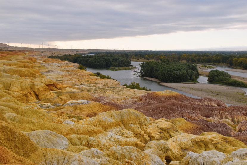


DAY5: Baihaba-Kanas-Jadenyu
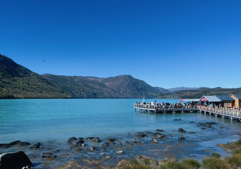
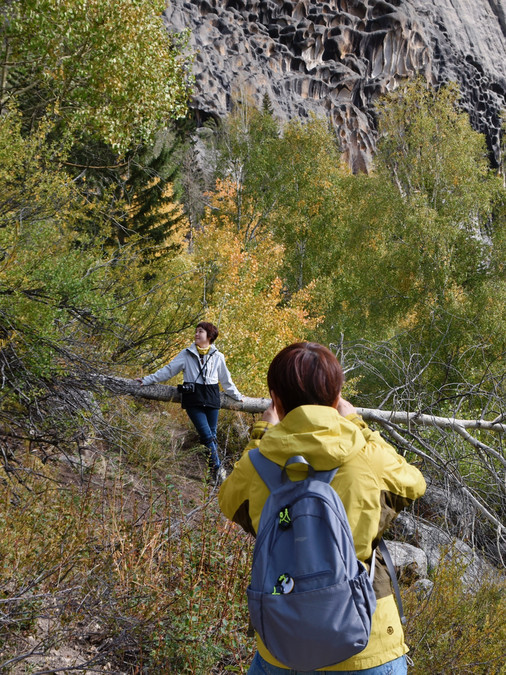
This day is basically playing in Kanas Scenic Area. From the bus terminal in Baihaba, you can take Kanas Line 2 directly to the transfer center in Kanas. We grabbed the tickets for Guanyutai first, so we immediately seamlessly took the bus to Guanyutai, during which we also distributed the extra tickets to the friends of other groups. After climbing Guanyutai, go down the mountain and take the No. 1 car to Kanas Lake, take pictures while walking for about 1 hour, then return to the transfer center, take the No. 3 line to Jiadenyu direction, and play Sanwan.
Flying drone in Fairy Bay, beautiful! About 30 minutes to take pictures, take a 5-minute car to Moon Bay, and then start hiking. When I was going down the mountain, I also met an old friend I hadn't seen for several years. I didn't expect to see him in Chengdu, but I met him in Xinjiang. I was very happy.
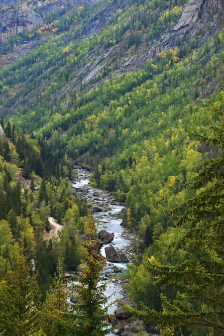
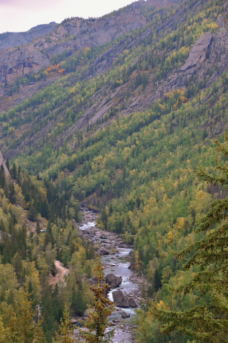
The hike from Moon Bay to Wolong Bay, walking from the observation platform to the riverside, and climbing from the riverside to the ride point later, are all laborious things, but walking by the riverside is very easy. The map shows 3.7 kilometers, in fact, it should be more than that, mainly because the steps down the mountain cannot be calculated, which is more difficult than the hike to Guanyutai, so you have to consider it carefully. The scenery by the river is very good, the white birch forest on the other side and the blue water of the lake are matched, and the snow-capped mountains in the distance are very outstanding. Go to the bus point to Jiadengyu for dinner and accommodation.
DAY6: Jiadengyu-Hemu
The journey from Jiadengyu to Hemu is not far, about 1 and a half hours. The scenery on the road is beautiful, as mentioned earlier, I won't go into details. To get to the door of Hemu, you also need to transfer to the scenic bus to Hemu Village, which is an hour's drive. The road runs in the riverside canyon, which is also very beautiful. The bus service is super good, very clean, and will also remind guests of their car ID, such as "Desert Rose" so that guests can find the car if they lose something.
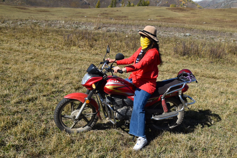
To the entrance of Hemu Village, then transfer to the village bus and go to our respective accommodation cabins. We went to have lunch first, then divided the rooms, put away the things and went to hike the beautiful peak. After drinking a hearty milk tea at the beautiful peak, I can't get too full! Finally, I wanted to experience the grassland motorcycle, so we took the motorcycle from the beautiful peak back to Hemu, 100 yuan per person, which is a lot more than the 320 on horseback!
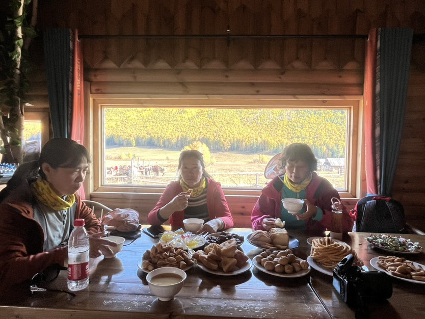
I was too tired in the afternoon to watch the sunset again, mainly Bai Haba's sunset was already very beautiful. The little friends made an appointment to eat what they thought was the best meal at the time of the trip (because there was something better to eat later), went to the campfire to dance, and went back to the cabin to sleep at 10 o'clock.
DAY7: Hemu-Wuerhe Devil Town-Wuerhe

Why did you say that it was the best meal at the time, because we had a better meal in Wuerhe. After breakfast at 9:30 in the morning in Hemu, everyone took their luggage and went back to their bus at the entrance of the scenic spot, then left Hemu and went to Wuerhe. We entered Kanas from Baihaba, which can be regarded as entering through the back door. We left Kanas from Hemu this time, even if it was from the main entrance; then we saw a long queue of vehicles preparing to enter the scenic spot, which stretched for about ten kilometers, all queued up and blocked, waiting for the traffic police to release a few cars and a few cars. It was very shocking! At that time, I thought, fortunately, we are following the Vigilante, and there is no such traffic jam. If I were driving by myself, I would definitely turn around and stop playing immediately!
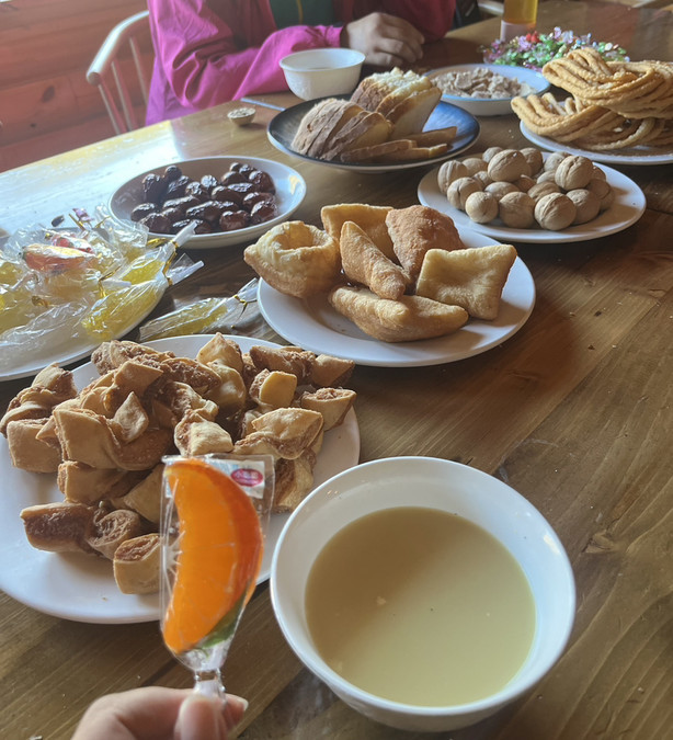
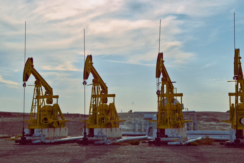
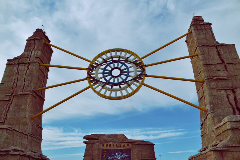
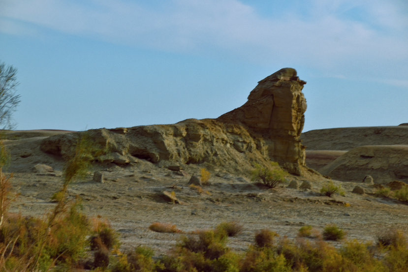
Wuerhe belongs to the Karamay area, and you will see a lot of "kowtow machines" producing oil on the way to Devil City. This Yadan landform in Devil City will be easier to play than other areas. The whole process is a small train, which takes turns. We took the last photo at the Sphinx, and then we kept talking about the story of the Seven Swords descending to Tianshan. Stayed in Wuerhe at night, tired for a few days, and slept very well tonight! It must be said that the restaurant in Wuerhe, called "Ajitai's Leg of Lamb", is really delicious! Highly recommended, must try it!
DAY8: Wuerhe Poplar Forest - Anjihai Grand Canyon
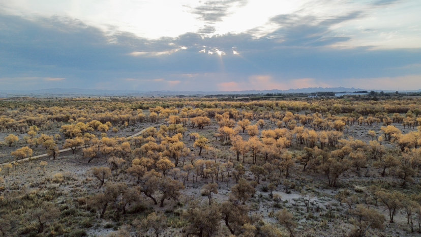
The Populus euphratica forest in Wuerhe is a new wild Populus euphratica forest. It was discovered by the leader of the Rovers during the treading process, and tickets were not charged before. Tickets started to be charged this year. With the local bus, there will be an additional fee for the local bus. We walked directly along the dirt road. The morning light gradually rose, passed through the clouds, and shone on the entire Populus euphratica forest. It was very spectacular. The little friends in twos and threes became part of the scenery. Everyone grabbed a fallen Populus euphratica tree and took pictures hard, several per person. Giant film.
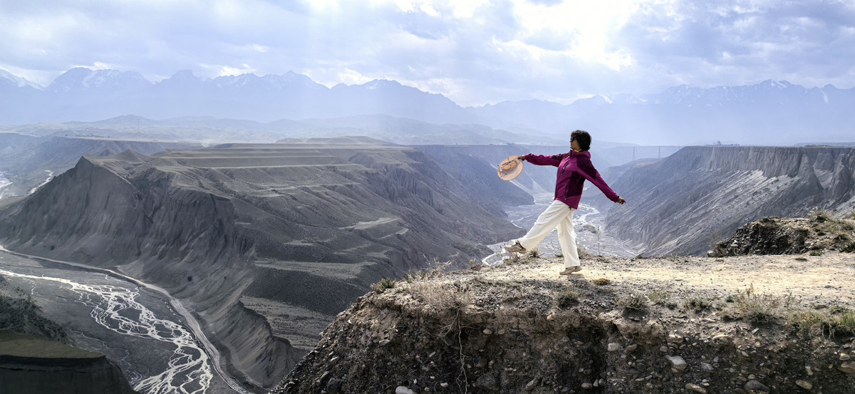
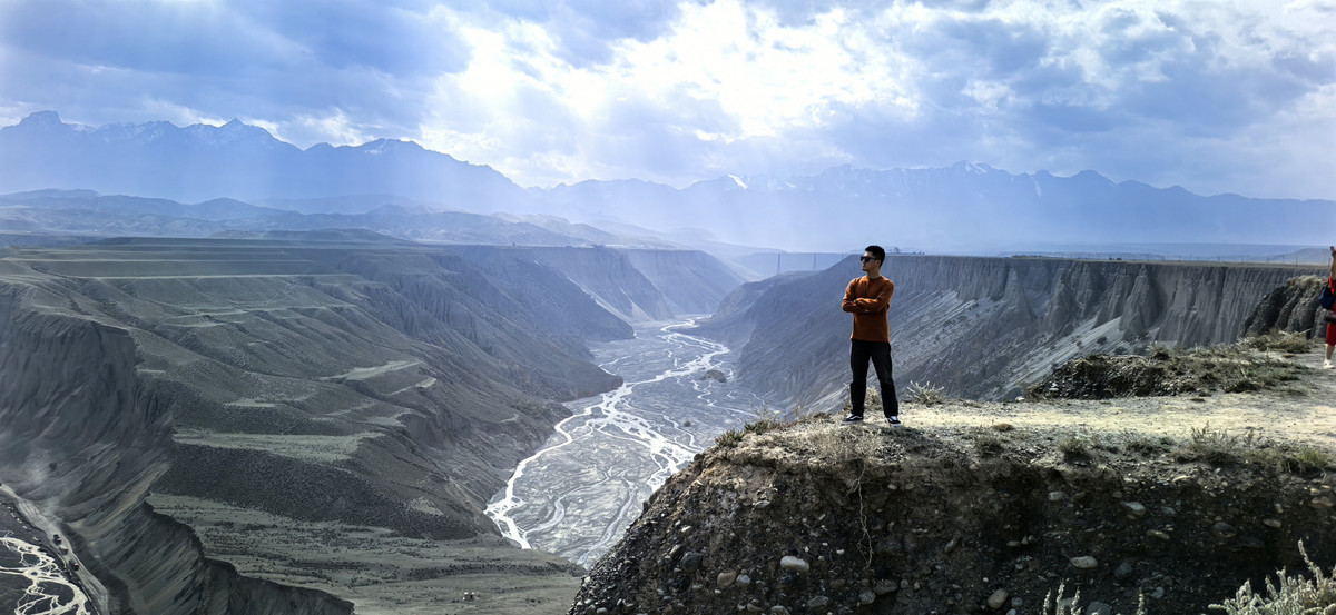
After walking out of Wuerhe and walking through the stone oil fields, there are cotton and pepper fields. The highway that lasts for several hours is a planting area, some of which are from the corps, some of which are contracted. The little friends were overjoyed when they saw cotton for the first time. Until Anjihai was shocked by the vertical canyons and stepped grasslands, at this time, the Tianshan Mountains were already close at hand. The bad thing is that on the day we went, the fog was relatively heavy, and there was dust in the air, so the photos taken were all gray.
Back to Urumqi in the evening, we will meet together to eat mutton barbecue, eat and drink enough, and then continue to eat and drink tomorrow.
DAY9: Home in Urumqi
This whole day, some early friends set off for the airport. If you have evening tickets, you can continue to go to the Grand Bazaar, go to the Hongshan Market to buy souvenirs, and eat other delicious food. Barbecue, mutton, haggis, beef, spicy chicken, all kinds of delicacies can be seen in the group, and there are photos of eating and drinking everywhere. Perhaps, this is the difference between the group and the self-driving car. In addition to the more perfect route design, the harvest may be the fate and kindness between people. The friends in our group are very beautiful, understanding and humbling each other, respecting each other's time, taking pictures of each other and partnering with AA food. These are the contacts with others that cannot be experienced on a self-driving trip. Again, it is not just where to go, but more importantly who to go with. Mountains, seas and heaven, we are accompanied by red dust, enjoy it at will!